
Brand
Michigan Map 18 x 24in
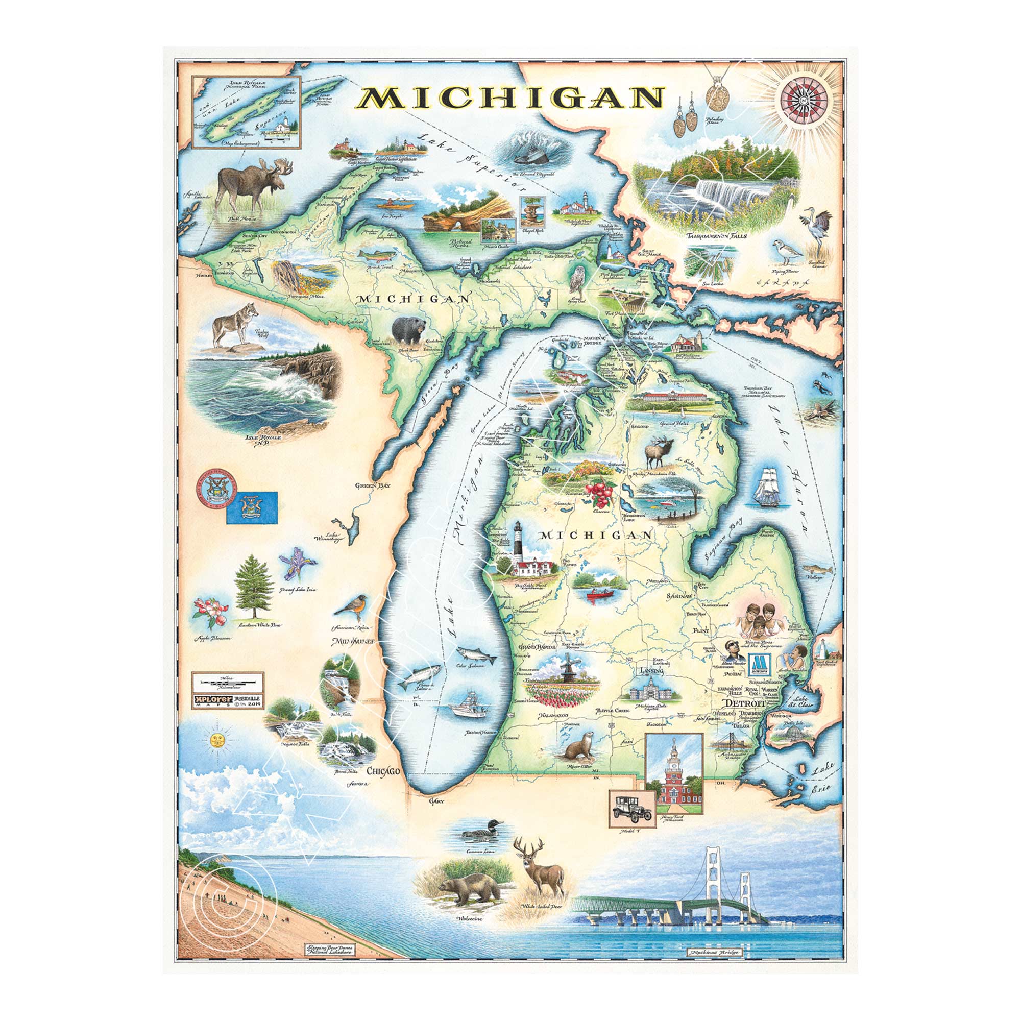
This original hand-drawn pen and ink/watercolor story map captures the beauty of Michigan and its surrounding Great Lakes. Located in the north Midwest of the United States, Michigan uniquely shares borders with four of the five Great Lakes: Lake Superior, Lake Michigan, Lake Huron, and Lake Erie. The state is divided into two distinct land sections, the Upper Peninsula and the Lower Peninsula, connected by the iconic Mackinac Bridge at the Mackinac Straits.
The lithograph print by Chris Robitaille of Xplorer Maps measures 18" wide by 24" tall unframed.
- Michigan Map 18 x 24in - $31.99